1. THE PUNJAB CANAL
Introduction
- Punjab, a key agricultural state in India, faces significant water scarcity impacting its irrigation infrastructure.
- Amidst a funds crunch and ongoing water management issues, the state government has proposed a new ₹2,300 crore irrigation canal named the Malwa Canal.
- This project aims to address the limitations of existing canals and improve water distribution, particularly in the water-starved southwestern region of Punjab.
Details of the Proposed Malwa Canal
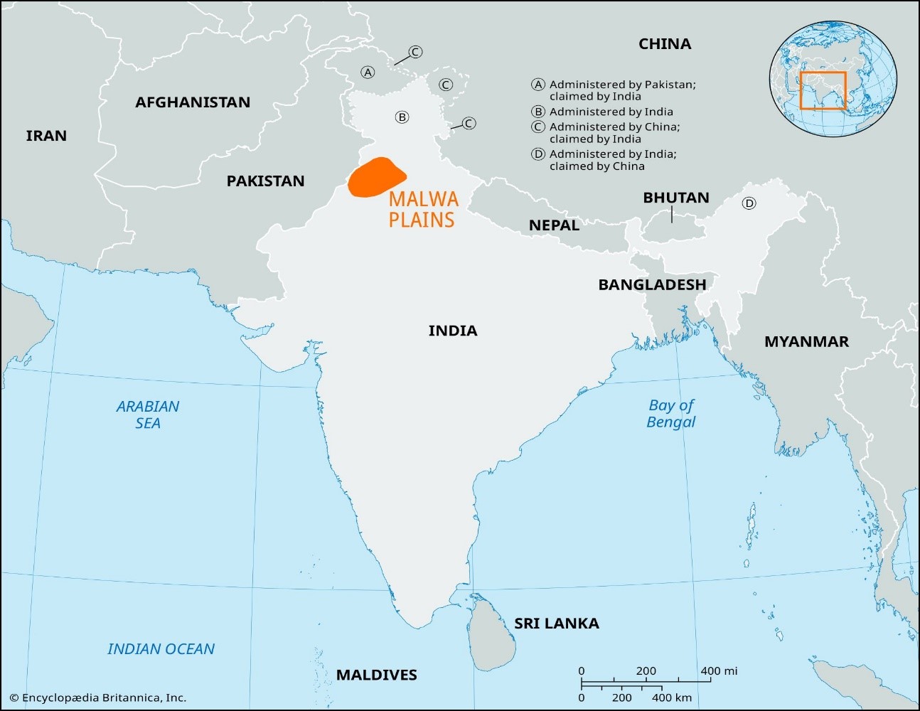
- Length and Route: The Malwa Canal is planned to be approximately 149.53 km long, extending from the Harike Headworks on the Sutlej River in Ferozepur district to Warring Khera village in Muktsar district, near the Haryana border.
- Dimensions and Capacity: The canal will be 50 feet wide and 12 feet deep, with a capacity to carry 2,000 cusecs of water.
- Objective: To provide additional water to areas inadequately served by the Sirhind Feeder canal, especially during high-demand periods like the kharif paddy sowing season.
Current Irrigation Issues
- Existing System: Punjab’s irrigation system includes the Bhakra Main Line, Sirhind Feeder, and Rajasthan Feeder canals. However, the Ferozepur Feeder and Sirhind Feeder are struggling to meet the state’s irrigation demands, leading to rotational water distribution and insufficient supply.
- Groundwater Depletion: Areas like Abohar and Fazilka have reported groundwater contamination, prompting requests for canal water to replace polluted groundwater sources.
Benefits of the Proposed Canal
- Increased Water Supply: Expected to enhance water availability for the Malwa region, benefiting districts such as Ferozepur, Faridkot, Muktsar, Bathinda, and Zira.
- Equitable Distribution: Aims to balance water distribution, addressing the current anomaly where Punjab receives only 68% of its Bhakra dam water allocation, while neighboring states get more than their share.
Challenges and Concerns
- Funding: The project faces a major challenge in securing ₹2,300 crore funding amidst Punjab’s debt of ₹3.5 lakh crore. The state government is exploring support from the National Bank for Agriculture and Rural Development (NABARD).
- Technical Feasibility: Concerns have been raised about the canal’s technical viability, including potential issues with water levels and the need for additional lift infrastructure.
- Regulatory Hurdles: The project will require environmental clearances, land acquisition, and assessments for human displacement and compensation.
- Political Factors: Tensions between the BJP-led central government and the AAP-led Punjab government may impact support and funding for the project.
Conclusion
The Malwa Canal project represents a significant attempt to improve water management and irrigation in Punjab’s water-scarce regions. While it has the potential to address critical water distribution issues and support agricultural productivity, it faces substantial challenges including financial constraints, technical feasibility, and regulatory approvals. The success of this project will depend on overcoming these hurdles and ensuring efficient implementation and management.
2. Nutritional Deficiency Among the Poor: Insights from the 2022-23 Household Consumption Expenditure Survey
Introduction
The National Sample Survey Office’s Household Consumption Expenditure Survey (HCES) for 2022-23 reveals critical data about the nutritional status of the poor in India. By analyzing the calorific value of consumed food and comparing it with required daily intake levels, the report sheds light on the nutritional deficiencies prevalent among different expenditure classes.
Methodology
- Defining the ‘Poor’:
- Lakdawala Committee: Defined poverty based on calorie norms (2,400 kcal/day for rural, 2,100 kcal/day for urban).
- Tendulkar Committee: Did not use calorie norms.
- Rangarajan Committee: Based on a basket of needs including nourishment and other non-food expenses.
- Caloric Needs Calculation:
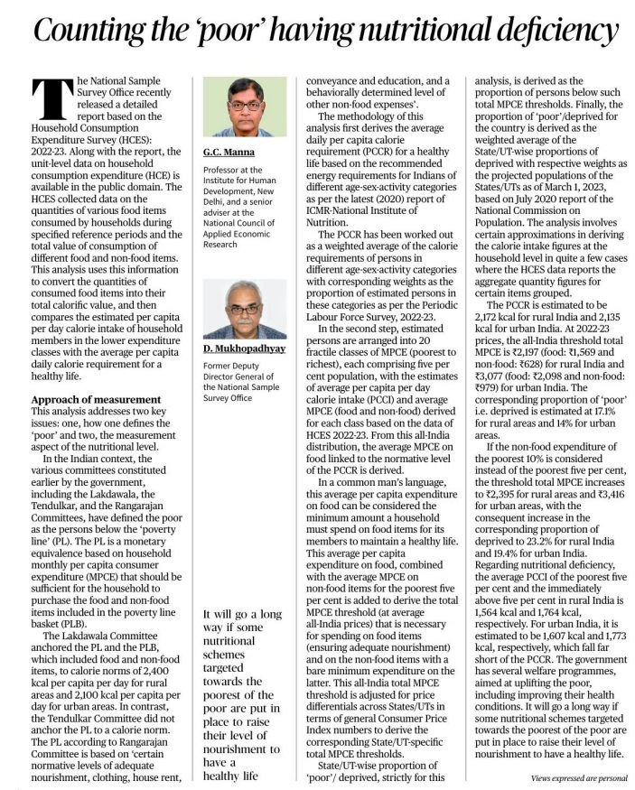
- Per Capita Caloric Requirement (PCCR): Based on ICMR standards, calculated as 2,172 kcal/day for rural and 2,135 kcal/day for urban areas.
- Expenditure Thresholds: Estimated based on average expenditure required for adequate nourishment and non-food needs.
- Data Analysis:
- Average Per Capita Calorie Intake (PCCI): Compared across different expenditure classes.
- Threshold MPCE: Calculated for both rural (₹2,197) and urban (₹3,077) areas to determine the poverty line.
Findings
Caloric Intake Shortfall:
- Rural: Poorest 5% have an average PCCI of 1,564 kcal (shortfall of 608 kcal), and the next 5% have 1,764 kcal.
- Urban: Poorest 5% have 1,607 kcal (shortfall of 528 kcal), and the next 5% have 1,773 kcal.
Poverty Proportions:
- Rural India: 17.1% below the expenditure threshold.
- Urban India: 14% below the expenditure threshold.
- If considering the poorest 10%, the proportions increase to 23.2% for rural and 19.4% for urban areas.
Implications and Recommendations
- Nutritional Deficiency: The shortfall in average calorie intake highlights a significant nutritional deficiency among the poorest segments.
- Policy Recommendations:
- Nutritional Schemes: Implement targeted programs to improve nourishment among the poorest.
- Welfare Programs: Enhance existing welfare initiatives to address both food and non-food needs.
Conclusion
The HCES 2022-23 data underscores the urgent need for nutritional and welfare interventions to address the significant calorie intake deficiencies among India’s poorest. Adjusting policies to improve food security and overall nourishment is essential to support a healthy life for these vulnerable populations.
Practice question |
Critically assess the role of government welfare programs in improving nutritional outcomes for the poor. What additional measures should be considered to bridge the gap identified in the HCES 2022-23 data? |
3. Uncovering the Earthquake that Redirected the Ganga: A 2,500-Year-Old Mystery
Title:
Introduction: Imagine a colossal earthquake so powerful it could alter the course of one of the world’s great rivers. This isn’t science fiction—it’s what happened around 2,500 years ago to the Ganga River, as revealed by a groundbreaking study published in Nature Communications.
Visual Journey:
- Timeline:
- Event: Around 2,500 Years Ago
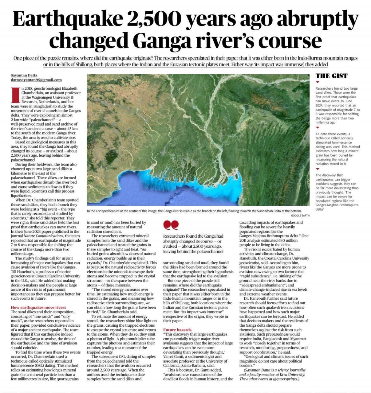
- Discovery: Researchers in Bangladesh uncover ancient river channels and sand dikes.
- Technique: Optically Stimulated Luminescence (OSL) Dating
- Map:
- Location: Ganga River Delta
- Key Areas: Indo-Burma Ranges, Shillong Hills
- Findings: Paleochannel and Sand Dikes
- Sand Dikes:
- Dikes formed as a result of an earthquake’s impact, causing the riverbed sediments to behave like a liquid.
Story Behind the Discovery:
A River’s Tale: Around 2,500 years ago, a massive earthquake struck a region where the Indian and Eurasian tectonic plates meet. This seismic event caused the Ganga River to suddenly change its course, leaving behind a trail of evidence.
The Sand Dike Mystery: Geologists uncovered large sand dikes in the river’s old course. These dikes are the key clues linking the earthquake to the river’s dramatic shift. The dikes formed from liquefaction—when the earthquake’s force turned solid sediments into a fluid state.
Innovative Techniques:
OSL Dating: Scientists used Optically Stimulated Luminescence (OSL) dating to uncover the age of the river shift and sand dikes. Here’s how it works:
- Step 1: Measure natural radiation trapped in mineral grains from sand and mud.
- Step 2: Expose grains to light and heat to release stored energy.
- Step 3: Analyze the emitted light to determine how long the grains have been buried.
Implications and Future Directions:
Impact on Populated Regions: The study’s findings reveal that large earthquakes can cause significant river shifts, which could be devastating for regions like the Ganges-Meghna-Brahmaputra delta, home to over 600 million people. This understanding is crucial for preparing for future seismic events and managing potential flooding risks.
Future Research: To better predict and prepare for such events, further research is needed to:
- Assess Frequency: Study how often earthquake-induced avulsions occur.
- Improve Forecasting: Develop better methods for forecasting such seismic activities.
- International Collaboration: Foster cooperation among India, Bangladesh, and Myanmar for effective risk management.
Conclusion:
This study not only sheds light on a fascinating historical event but also underscores the need for enhanced earthquake preparedness. By understanding how past seismic events have shaped our environment, we can better protect future generations from similar natural disasters.


